Pages

Showing posts with label franklin county va. Show all posts

Sunday, February 10, 2013

Doss Photography captures the beauty of our area

Darrin Doss lives here in Franklin County and takes the most incredible photos. 
If you follow him online you will usually let out a gentle ahhhh when you see his photos. Especially those photos in and around our area, from Rock Castle Creek to the Smith River. 
Note from Shellie - the photo above is one of my all-time favorite places to hike and photograph wildflowers in the Spring! This is Rock Castle Creek.  It is a Virginia Birding and Wildlife Trail here in the Blue Ridge Mountains. See trail map and directions here (there is limited parking so carpool y'all)

Sunday, October 28, 2012

New herp county records for Franklin County!

Dr Todd Fredericksen shares this exciting news:
The first recorded captures in Franklin County of the Eastern Spadefoot (Scaphiopus holbrookii) and the Eastern Musk Turtle (Sternotherus odoratus) occurred at Ferrum College this past summer.  
Click image for larger view of the Spadefoot
The Eastern Spadefoot spends most of its time below ground and occurs mostly in the Coastal Plain with a few scattered locations in the Mountains.  It was captured in a pitfall trap in a hardwood forest following a heavy rain in July. 
Click image for larger view of the Must Turtle
The Eastern Musk Turtle, also called the “Stinkpot”, is rare in the upper Piedmont and Mountains and was captured with a net trap in a small pond in September.

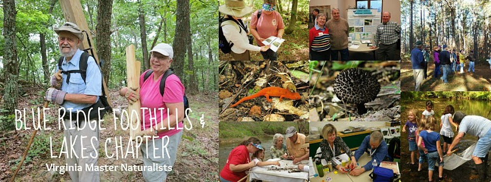
Dr Todd Fredericken is a member of the Blue Ridge Foothills and Lakes Chapter of Virginia Master Naturalists. He is also one of our treasured instructors for the VMN Basic Training Program. The next training is scheduled for Fall 2013!

Tuesday, August 28, 2012

Moonshine Beekeepers

CHANGING THE WORLD ONE HIVE AT A TIME!
Photo by Jeff Jenner Moonshine Beekeeper
The Moonshine Beekeepers Association is a not-for-profit organization dedicated to assisting current and future beekeepers of Franklin and surrounding counties in Virginia. Our Mission is to provide our membership with interesting and practical knowledge as well as promoting public awareness of the benefits, necessity, and value of the honeybee to human existence.

The purpose and objectives of our association are to:
  • Share knowledge, experiences and adventures of beekeeping
  • Educate the community about the joys, skills and benefits of beekeeping.
  • Serve as a resource to local beekeepers.
  • Provide an outlet for the membership to sell member-produced honey and other hive products.
  • Foster interactions with the local agricultural community and other beekeeping organizations.

Visit the website here: http://moonshinebeekeepers.org/
Visit the Facebook page here: http://www.facebook.com/MoonshineBeekeepersAssociation

LEARN MORE ABOUT THE MASTER NATURALIST PROGRAM HERE

Thursday, July 12, 2012

Tree-identification signs installed at Grassy Hill Natural Area Preserve

Official Press Release from DCR June 28, 2012
Tree-identification signs installed at Grassy Hill Natural Area Preserve


RICHMOND -- Identifying tree species just got easier for visitors to Grassy Hill Natural Area Preserve in Franklin County.


Tree-identification signs recently were installed along the preserve’s 1.6-mile Slope Trail. The signs give scientific and common names for 25 species, as well as basic information and uses for each.


“The signs introduce visitors to the diversity of tree species found in the western Piedmont and increase the educational value of this natural area preserve for residents of Franklin County and the nearby Roanoke Valley,” said Ryan Klopf, DCR’s mountain region steward.


Trees that have been identified with signs include white oak, eastern red cedar, Virginia pine, pitch pine, redbud, witch hazel, cucumber magnolia, tulip poplar, pignut hickory, black gum, serviceberry, red maple, sourwood and dogwood.


“Our thought with this project was to raise people’s awareness about trees in general,” said Denny McCarthy, a senior forester with DOF who helped identify trees and install the signs.


Grassy Hill is on the west side of the town of Rocky Mount. Evidence suggests the site once was more open and dominated by grasses than it is today — hence the name. Scars on older trees indicate a landscape once maintained by fire. Today, prescribed burning is one technique used by natural resource professionals to enhance conditions for the preserve’s plants.


Visitors can experience Grassy Hill along five miles of hiking trails. The preserve is well-suited for environmental education and passive recreation such as hiking, nature photography and bird watching. Uses that are prohibited include camping, mountain biking, horseback riding, off-road vehicles and the collection of wild plants and animals.


The trailhead is about 500 feet northeast of the Franklin County Family YMCA at 235 Technology Drive, Rocky Mount. Visitors may park in the YMCA lot. Parking also is permitted at the Gereau Center for Applied Technology and Career Exploration. More here.


DCR manages 60 properties in Virginia’s Natural Area Preserve System. The system was established in 1989 and today consists of 50,580 acres. Natural area preserves contain some of the best examples of natural communities and rare plant and animal habitats in Virginia and the world.

TO LEARN MORE ABOUT THE VIRGINIA MASTER NATURALIST PROGRAM CLICK HERE
Monday, June 4, 2012

BRFAL Chapter Member Photos on Display

We are proud to announce that Blue Ridge Foothills and Lakes Chapter Member Carl Boast has 18 Wildlife and Nature Photos on Display at the Franklin County Library in downtown Rocky Mount VA. 
You can see this full size image by Carl and more at the Franklin County Library
We invite you to come out and see some of Carl's beautiful photos now until July 15th, 2012!  The displayed photos are all Nature/Wildlife from various locales including Alaska, Costa Rica, Australia, New Zealand and nearby.

View Larger Map

Wednesday, April 4, 2012

Rip Tide in the Sky

A little over a week ago we had some severe weather here in our Blue Ridge Foothills and Lakes area. 
I saw my first ever green looking cloud formation and actually watched the clouds that were moving forward back-draft to the big cloud.  I likened it to a "Rip Tide in the Sky." Other parts of our county had heaps of hail, like the Bedford County side, where we had only pea sized hail in the Town of Rocky Mount.
Severe weather here in Rocky Mount VA as reported from The Claiborne House B&B
I took these images from my porch here in Rocky Mount VA

Monday, December 5, 2011

BRFAL Members Help Save Our Streams

GOOD BUGS = GOOD WATER

Alongside Blue Ridge Foothills and Lakes Virginia Master Naturalists 
Training Session with Don Kelso (preparing to catch the bugs - macroinvertibrates tell the health of a stream)

Tuesday, November 29, 2011

Is 'Brown' the New Green?

Virginia always looks so green, but at times we too encounter drought 
Two years ago the Town of Rocky Mount would not allow us to water any outdoor plants (hanging or otherwise) and began to truck in drinking water. The level at our two lakes was extremely low, boats had to look up to see the docks. Worst case scenario of course was gazing out over the fields upon the Franklin County Farms. This area is predominantly dairy farms, and they got the short end of the stick!
Franklin & Bedford Counties are Dairy Country

Sunday, October 2, 2011

Farms Dominate Landscape Here

Despite Pockets of commercial and residential development, farms remain the dominant feature in Franklin County's landscape.
Franklin County farm facing east and fall scenery
  • Franklin County ranks eighth among Virginia's 95 counties in the amount of farmland, according to the most recent U.S. Census of Agriculture.
  • Franklin County has 166,592 acres of farmland, according to the census.
  • Bedford County ranks fifth with 212,237 acres.
  • Franklin County also ranked among the top 10 counties for Virginia Farm income, according to the census.
  • The average Farm in Virginia generates $61,334 worth of sales according to figures from the national Agriculture Service (NASS).
  • The average size of a Virginia farm is 171 acres, according to NASS.
The BRFAL Chapter of Virginia Master Naturalist visited a local Dairy Farm as part of their basic training last Spring and saw the day to day operations. I cannot commend our local Farmers enough for all they do to produce quality dairy products for us! 
IF YOU ENJOY YOUR FOOD - THANK A FARMER!
If you are interested in the Virginia Master Naturalist program and want to learn more about it, or when the next training will be held, click here.

Monday, September 12, 2011

DCR Natural Heritage Program 25th Anniversary Field Days!

Explore some of Virginia’s best-kept natural areas Oct. 8
Grassy Hill, Franklin County
Ryan Klopf - Mountain Region Steward, Virginia Natural Heritage Program Time: 10 a.m.
Location info here

Tuesday, September 6, 2011

Create a Certified Wildlife Habitat


Turn Your Yard Into a Haven for Wildlife!

By providing food, water, cover and places for wildlife to raise their young, your garden can join the nearly 140,000 Certified Wildlife Habitat™ sites across the country.
Whether you have an apartment balcony or a 20-acre farm, you can create a garden that attracts beautiful wildlife and helps restore habitat in commercial and residential areas. By providing food, water, cover and a place for wildlife to raise their young--and by incorporating sustainable gardening practices--you not only help wildlife, but you also qualify to become an official Certified Wildlife Habitat™.

How to Create a Wildlife-Friendly Garden

Monday, August 8, 2011

Can you Identify this Virginia Bird?

A striking black-winged red bird, it is a common species of the eastern forest interior. 
Scarlet Tanager
photo © 2010 Mike & Chris | more info (via: Wylio)

Despite its brilliant coloring it is often overlooked because of its rather secretive behavior and its preference for the forest canopy.

Sunday, June 12, 2011

Birding Location: Smart View Recreation Area

Recommended Birding Location from MyBirdMaps.com:

Smart View Recreation Area in Franklin County VA

Chickadee closeup
photo © 2011 John Benson | more info (via: Wylio)

The Smart View Recreation Area is a top location for birdwatching in the State of Virginia. The Smart View Recreation Area is profiled on the United States Geological Service (USGS) Endicott Topological map. The Smart View Recreation Area is located at the latitude and longitude coordinates of 36.9259683 and -80.1864329 at an elevation of 659 feet. Smart View Recreation Area is situated in Franklin County in the State of Virginia. Birding enthusiasts interested in experiencing the many wonderful bird families in the surrounding areas of Smart View Recreation Area should print out the Topological map and bring it along on their birdwatching adventures. Birdwatching enthusiasts should also draft and submit a comment or report on Smart View Recreation Area to allow your fellow birdwatchers to learn about Smart View Recreation Area.


We truly hope your birdwatching and outdoor adventures are more fullfilling through the use of our social birding website (www.mybirdmaps.com). Before visiting any birding location always contact the Virginia Department of Natural Resouces (DNR) to confirm there are public access to these locations. Our birding site also provides users the ability to record your our topological maps, establish birding groups to communication with your birding friends and family, find birding shops and birding event locations and most importantly the ability to submit your bird sighting photos for contests to win birdwatching equipment and accessories.

Visit Mybirdmaps.com to see google map and topo map of Smart View Recreation Area and more information.
More information about Franklin County Virginia click here.
GET OUTSIDE and DON'T FORGET TO TAKE THE KIDS OR GRANDKIDS WITH YOU!

Sunday, May 29, 2011

Rabies on the Rise

Rabies cases increase in New River Valley

Officials advise pet owners to vaccinate cats, dogs and ferrets against rabies.

CHRISTIANSBURG -- Rabies cases are increasing in the New River Valley.

The New River Health District said Tuesday that 15 cases have been confirmed this year. That matches the 15 cases confirmed in all of 2010.

Two cows and a bobcat are among this year's cases. The other cases were raccoons, skunks and cats.

Health district director Dr. Molly O'Dell says there were a cluster of cases in Giles County.

The health district advises pet owners to vaccinate cats, dogs and ferrets against rabies.

Here is another article in the Roanoke Times about a Rabid bobcat in Floyd VA May 26, 2011. 

BRFAL Chapter of Virginia Master Naturalist warns to take caution around animals you do not know, never pick up an injured or sick animal, or go near any animal that is acting strangely, call animal control  immediately at 540-483-7440. 


Animal Control for Franklin County Virginia can also be reached via the Franklin County Sheriff Dept dispatch 540-483-3000.

Saturday, May 14, 2011

A Mushroom with Gills

Field-Trip to Booker T Washington National Monument Brings up Interesting Flora, Fauna and Fungi! 
One of the fun and unique things we spotted in our field training was this Oyster Mushroom.  As every good Virginia Master Naturalist does, I came home and immediately had to get more information!  So enjoy these photos from today and the information I found afterward, online. Tim Quinn, Victoria Keenum and Don Kelso led this troupe of Naturalists-en-training and did a fantastic job!
BRFAL Virginia Master Naturalists en-training using their field guides for identification
Oyster Mushroom

This mushroom has gills!
Pleurotus is a genus of gilled mushrooms which includes one of the most widely eaten mushrooms, P. ostreatus. Species of Pleurotus may be called oyster, abalone, or tree mushrooms, and are some of the most commonly cultivated edible mushrooms in the world. (No we didn't eat it or cut it to bring home, since this is National Park Service land!)

The caps may be laterally attached (with no stem). If there is a stem, it is normally eccentric and the gills are decurrent along it. The term pleurotoid is used for mushrooms having this general shape.

Pleurotus fungi are found in both tropical and temperate climates throughout the world. Most species of Pleurotus are white-rot fungi on hardwood trees, although some also decay conifer wood.


Scientific Classification
Kingdom: Fungi
Phylum: Basidiomycota
Class: Agaricomycetes
Order: Agaricales
Family: Pleurotaceae
Genus: Pleurotus

*Information from Wiki, more here.  
  • Visit Booker T Washington National Monument - admission is free. Directions and more info here
  • Booker T Nat Monument is in Franklin County, VA - where is Franklin County? Learn more about it here
BRFAL Chapter of Virginia Master Naturalist are all about FUN (gi)! Get outside and see what fun you can find.